0+240 · The signal
This is a road,
felt through a pocket.
The marker tracks the same position the road above is showing. Coloured stretches are where local roughness crosses into the severity ramp.
- 100 Hz
- accelerometer and gyroscope
- 1 Hz
- position fix
- 92–93%
- reported accuracy for binary good/bad road classification from gyroscope and accelerometer fusion [CMU, arXiv:1710.02595]
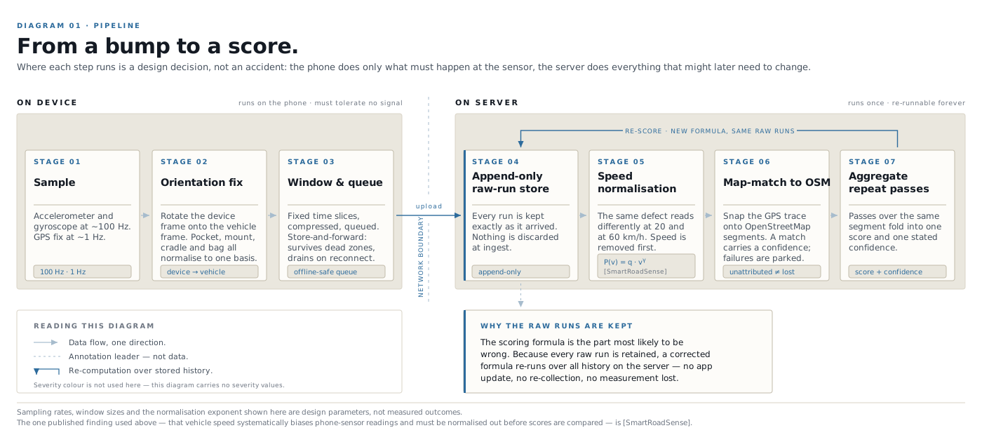
A phone samples vertical acceleration and rotation about a hundred times a second, alongside a position fix roughly once a second. On a good surface the trace is almost flat. Over a broken one it is not, and the shape of the break is specific enough to tell a pothole from a speed bump.
Before any of that is usable it has to be corrected for how the phone is sitting. Orientation correction rotates the reading out of the phone's frame into the vehicle's, which is what makes it possible to leave the phone in a pocket instead of clamped to a windshield.
Whether a pocket works at all is genuinely unproven. Nearly every published study used a dashboard or windshield mount, and mounting is a first-order factor in the result. This is the single biggest thing the Mumbai pilot is built to find out, and we would rather say so now than discover it in public later.
0+520 · Confidence
One pass is a guess.
Many passes are a fact.
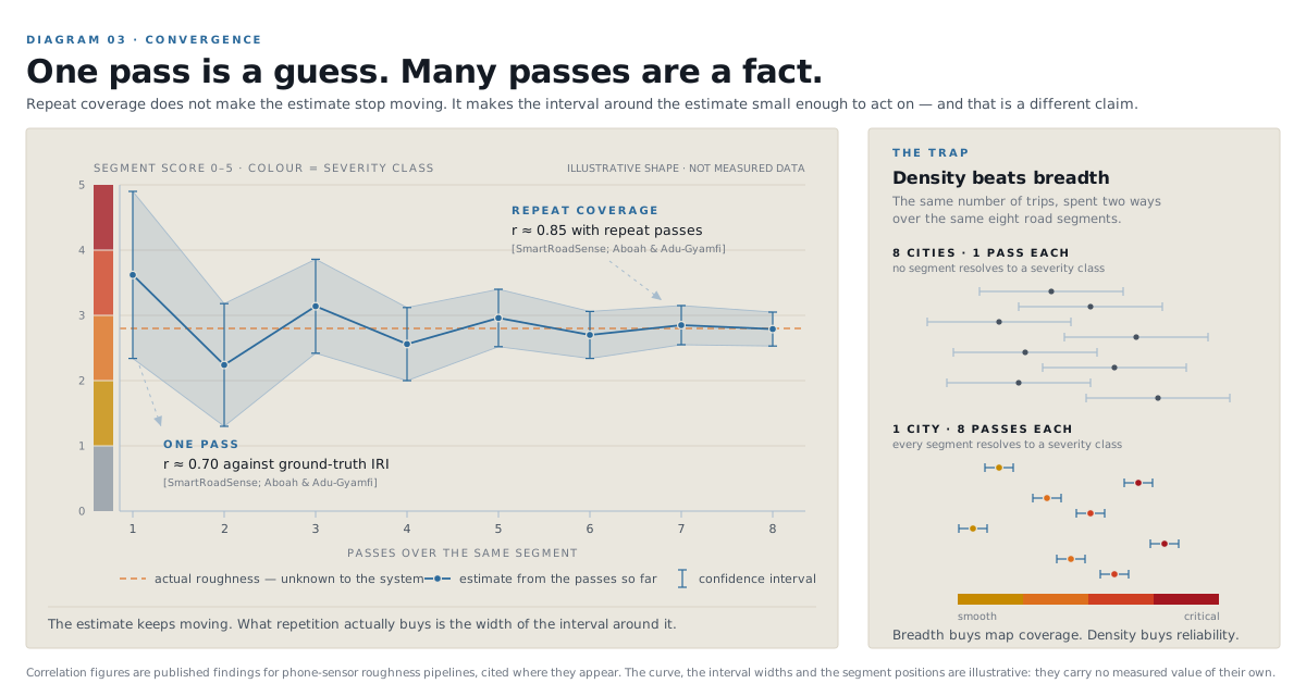
A single ride past a segment cannot separate a broken road from a bad line through it. The measurement only becomes worth anything when independent people cross the same stretch and their readings agree. Drag the control and watch what that costs.
- Correlation with reference
- 0.70
- Confidence band
- ±2.05
- Confidence
- 28%
The two endpoints are measured findings: roughness from a phone correlates with ground-truth road roughness at about r = 0.7 on a single pass, rising to roughly 0.85 with repeat coverage [SmartRoadSense; Aboah & Adu-Gyamfi]. The path between them, on Mumbai's roads and Mumbai's vehicles, is exactly what the pilot exists to measure. Treat the curve above as an illustration of the shape, not a result.
0+760 · Method
From a bump
to a score.
Raw readings are kept forever and the score is computed from them afterwards, on the server. That ordering matters: it means the formula can be corrected and every run ever recorded re-scored, without asking a single person to update an app.
Two kinds of evidence
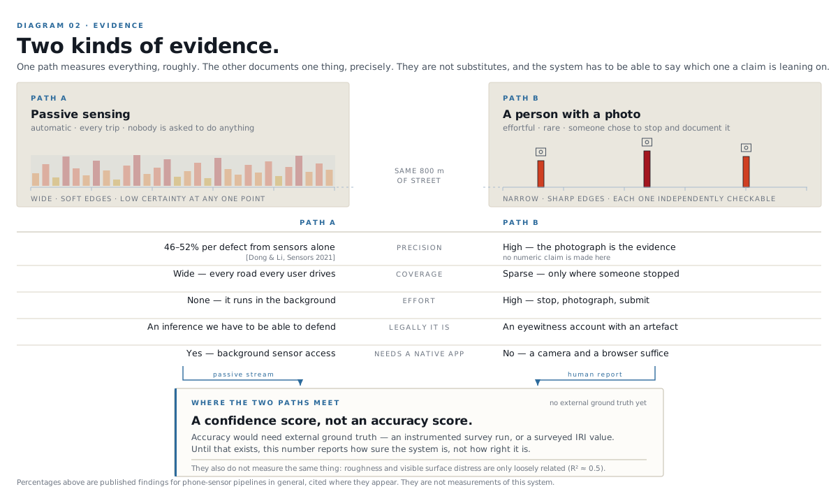
A sensor and a person are good at opposite things. The sensor covers ground nobody would bother to report; a person with a camera can be certain about one spot. The map is built from both, and it never confuses one for the other.
1+320 · What you'll see
Two surfaces.
One measurement.
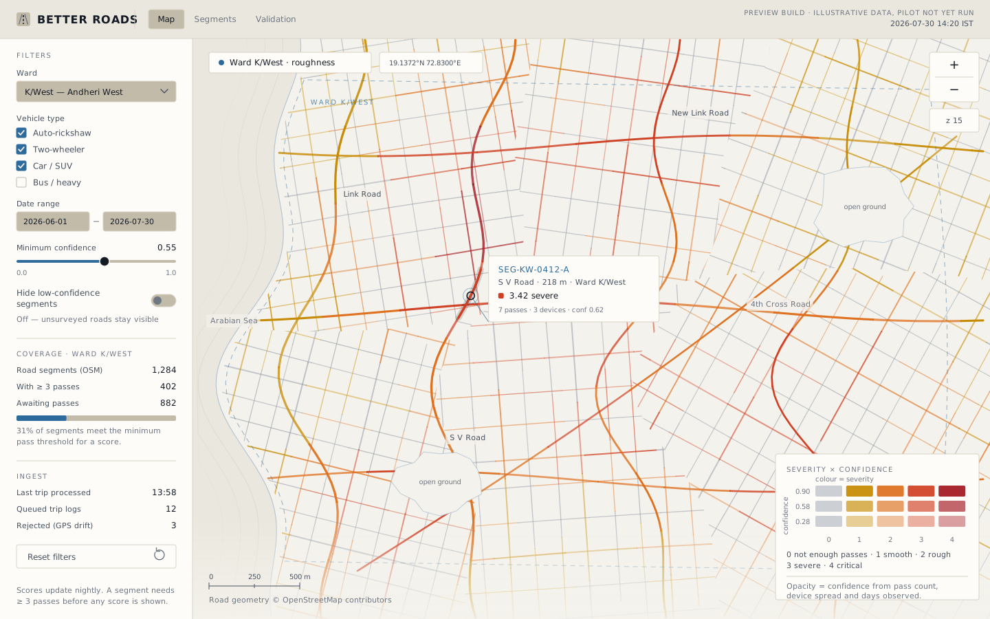
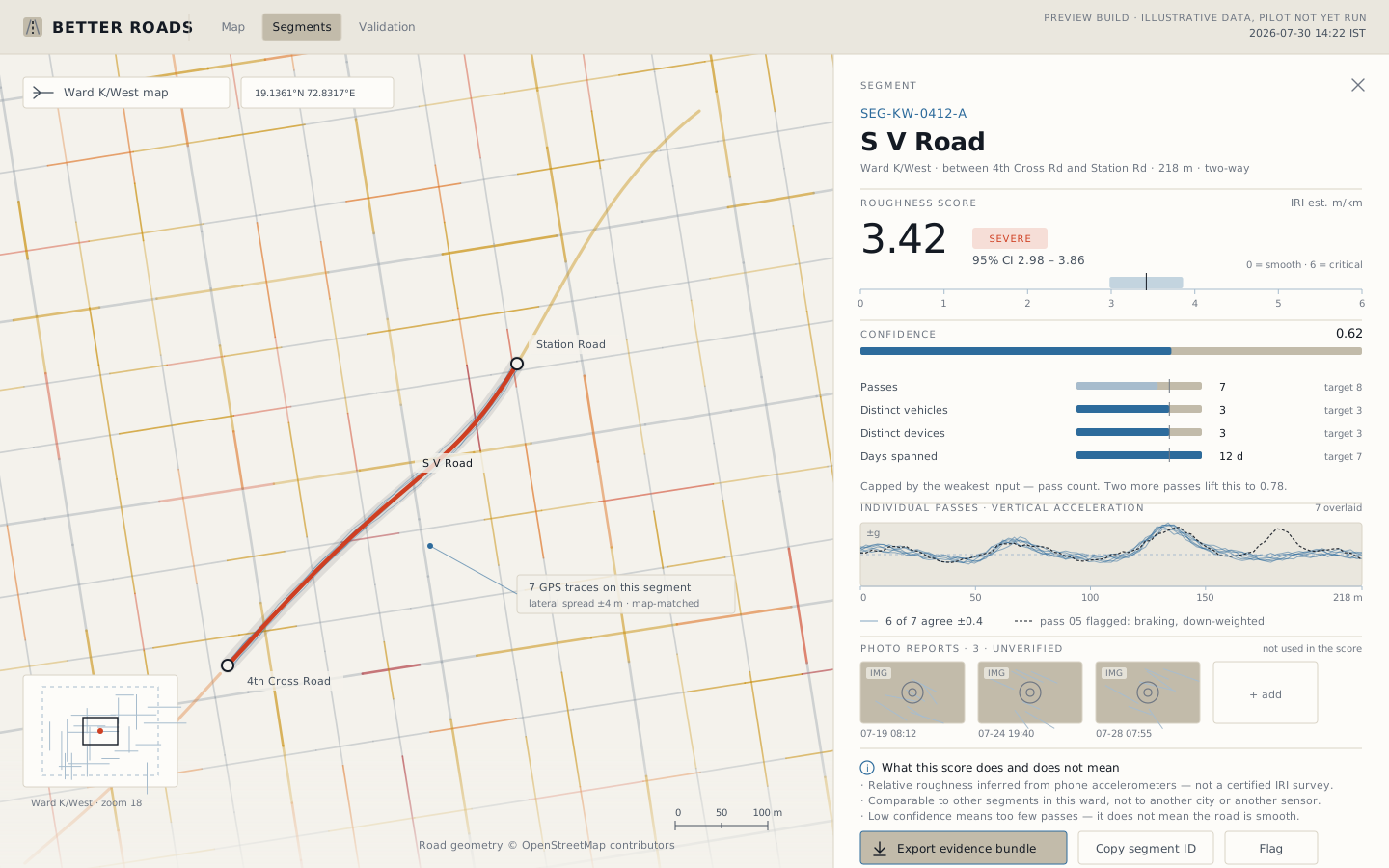
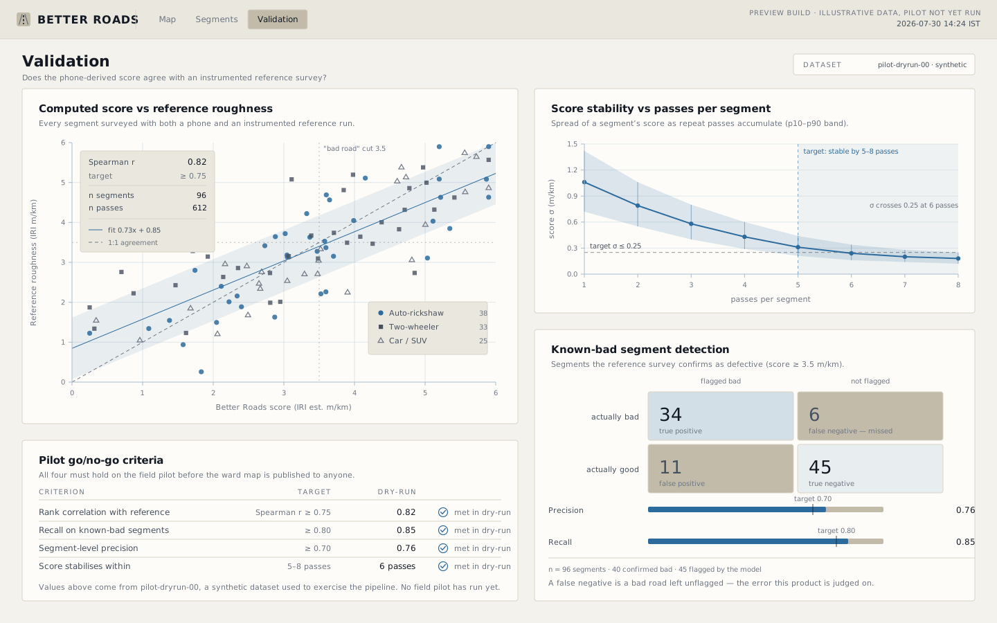
Reporting a pothole and looking at the map need nothing more than a browser, so they work from a link on day one. The passive sensing app is the part that needs to run in the background while you ride, and that is the part that has to be installed.
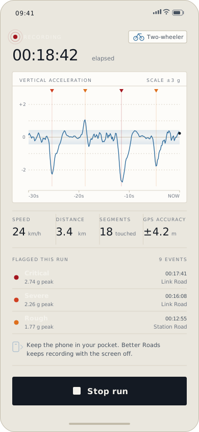
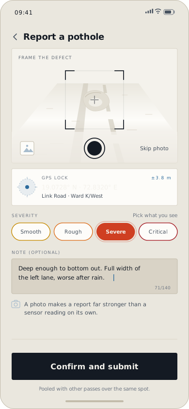
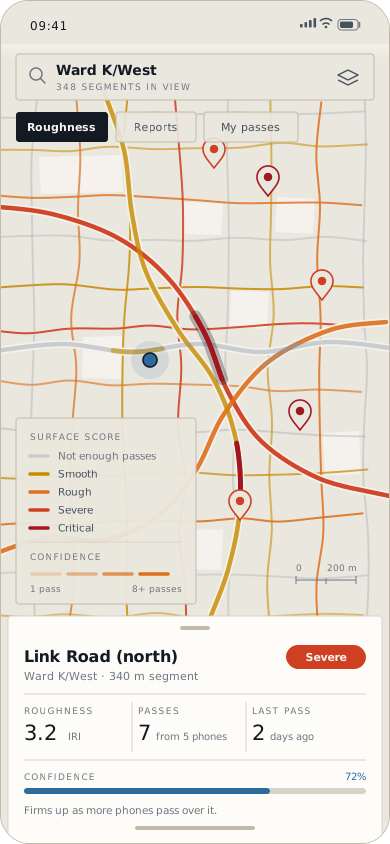
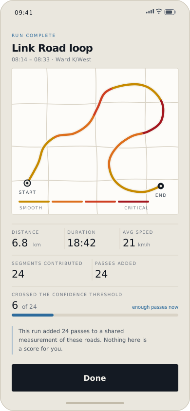
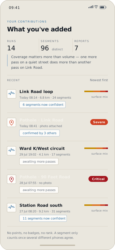
Interface designs. The app is in build — nothing here has shipped yet.
1+600 · Limits
What we won't claim.
Civic data dies from overreach. A map that overstates what it knows gets taken apart by the first person who checks it, and everything true on it dies alongside the part that wasn't. So here are the limits, in public, before there is anything to defend.
-
We won't call one reading a pothole.
Per-defect precision from phone sensors alone runs at 46–52% [Dong & Li, Sensors 2021] — around half of what a sensor flags isn't there. Sensors tell us where to look. A person with a camera is what makes it a defect.
-
We won't put a person's name next to a score.
Roads and wards, not individuals. Scoring a named official or contractor off data that is half right invites a defamation suit, and the case would bury the measurement long before it fixed a road.
-
We won't show a number without its working.
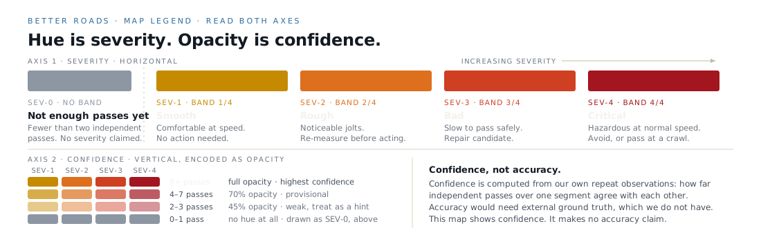
Every score carries how many passes made it, from how many different vehicles and devices, over how many days. When that is thin, the segment stays grey and says so, rather than guessing in colour.
-
We won't call confidence "accuracy".
Accuracy is agreement with an external reference. Until a surveyed reference exists for a stretch of road, no honest accuracy figure exists for it either. What the map shows is confidence: how strongly our own repeat observations agree with each other. Earning the first is the entire point of the pilot.
-
We won't keep the ends of your trip.
The first and last stretch of every run is dropped before storage, so a route can't be read backwards to a front door. Contributor identifiers are pseudonymous, and how long raw data is kept will be stated before anyone records anything.
1+880 · The plan
Mumbai first.
Then everywhere
it holds up.
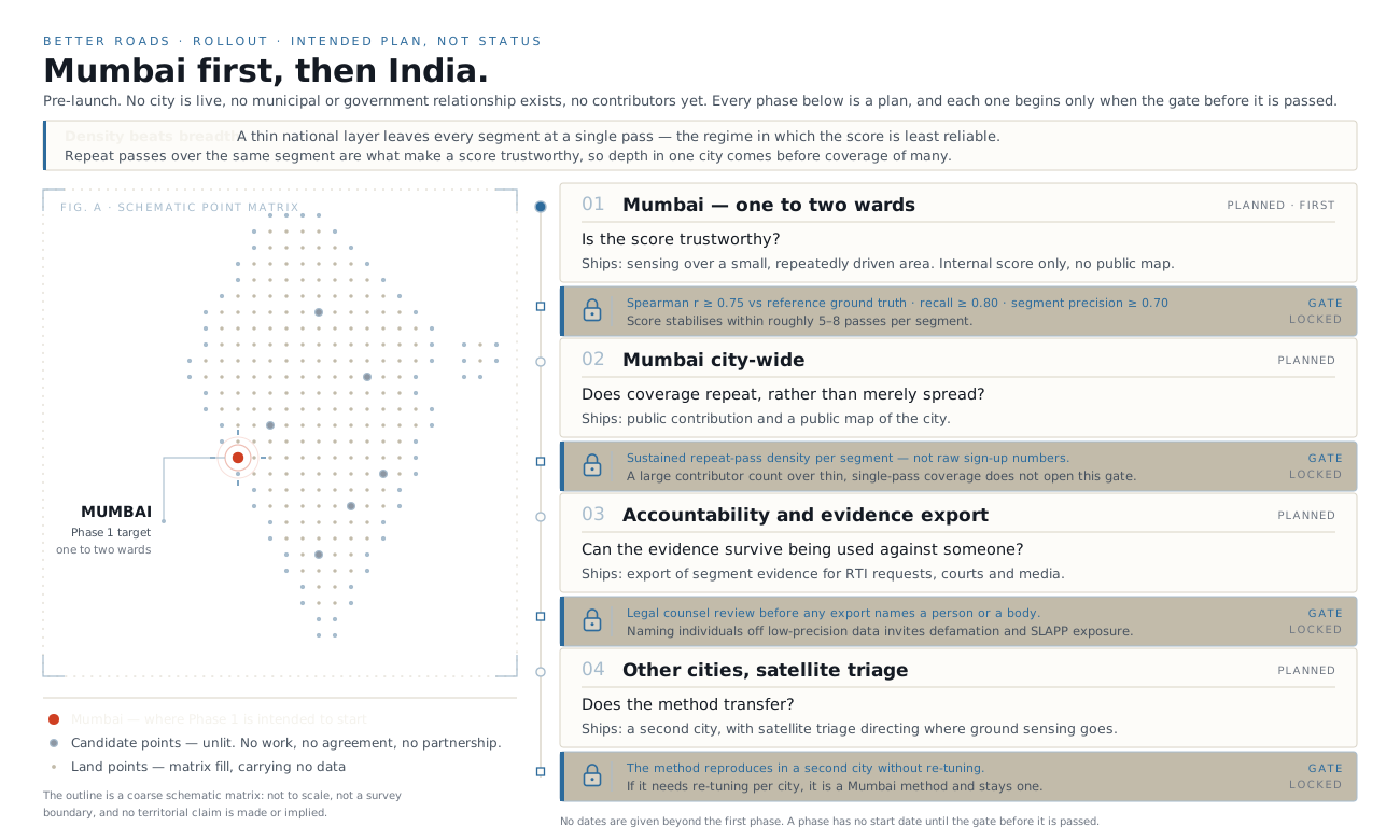
Schematic, not to scale, and not a boundary reference. One point is lit because one city is where this starts.
Every phase below is a plan, and every plan is gated on evidence from the phase before it. None of them are commitments to a date, because the thing that decides whether Phase 2 happens is whether Phase 1's numbers hold — not whether a calendar says it should.
If the score does not survive the first gate, the honest outcome is to say so publicly and fix the method. A civic dataset that is wrong at national scale is worse than no dataset at all.
2+400 · Join
The first runs are
in Mumbai.
The pilot needs a small number of people who ride the same roads regularly, on a mix of two-wheelers, cars and autos. Repetition is worth more than reach here — the same commute, several times a week, is the most useful thing anyone can contribute.
We will only write to you about the Mumbai pilot. Your address is not passed to anyone outside the project, and you can ask us to delete it at any time.
Not collecting yet. Until signups are connected, this opens your mail app with the message ready, rather than pretending to have saved anything.